Top-down analysis
Robust mapping of habitats and marine landscapes on the regional to medium scale
Work package WP1 involves:
- Development of objective classification methods for deep marine landscapes
- Evaluation of different automated image segmentation techniques for (AUV/ROV-based) multibeam and sidescan sonar data
- Performance assessment through replicate surveys
- Development of a confidence assessment methodology
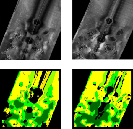
Results:
- Objective automated classification technique for marine landscape mapping in complex deep-sea environment, including confidence assessment
- published in Marine Geology (Ismail et al., 2015)
- Application for mega-MPA characterisation published in Nature Scientific Reports (Hogg et al., 2016)
- Summarised in handy 2-page factsheet
- New toolbox for the ArcGIS 10.x software to support automated image segmentation. Also summarised in a 2-page factsheet