Bottom-up analysis
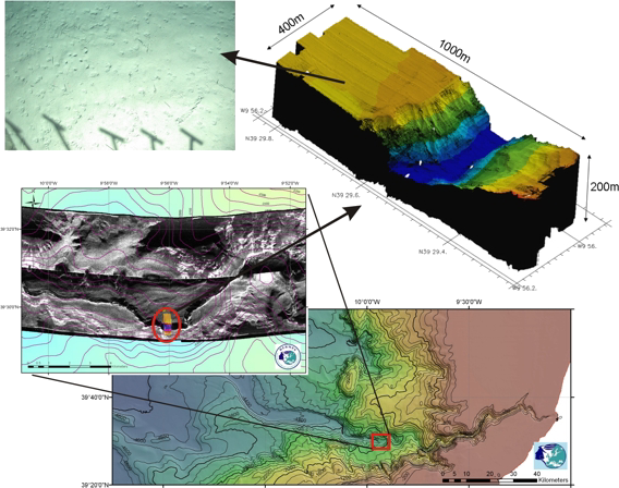
Finding quantitative relationships that can bring infomation from a more detailed to a broader scale
Work package WP3 aims:
- Extrapolating the maximum amount of quantitative information from the highest-resolution data (which have limited coverage) to the extensive surface area covered by the lower resolution data
- Based on nested optical/acoustic surveys with medium-scale sidescan sonar data as stepping-stone
- An evaluation of fractal theory and novel kriging algorithms.
Results:
- Predicting diversity distributions in Whittard Canyon (Robert et al., 2015; Marine Ecology)
- Combining model outputs using ensemble techniques to create more robust predictions (Robert et al., 2016; Deep-Sea Research)