Science
Science
Submarine Canyons are the main transport pathways between the shelf and the deep sea, and are often considered biodiversity hotspots. Their irregular topography can create specific oceanographic effects that result in extra primary productivity at the sea surface, which then gets transported to deeper waters through the canyon. At the same time, the steep canyon walls and enhanced sediment dynamics create a wide range of seabed substrates, providing different niches for a large variety in faunal communities. With human activities moving into deeper and deeper waters, some of these communities may now be under threat. For example, research by Spanish colleagues has shown that deep-sea bottom trawling on the upper flanks of a submarine canyon may have severe impacts, smoothing the topography, stirring up sediment and smothering seafloor animals. There is a strong need for effective marine spatial planning in submarine canyons, and the availability of accurate habitat maps generally is the first prerequisite for this planning process.
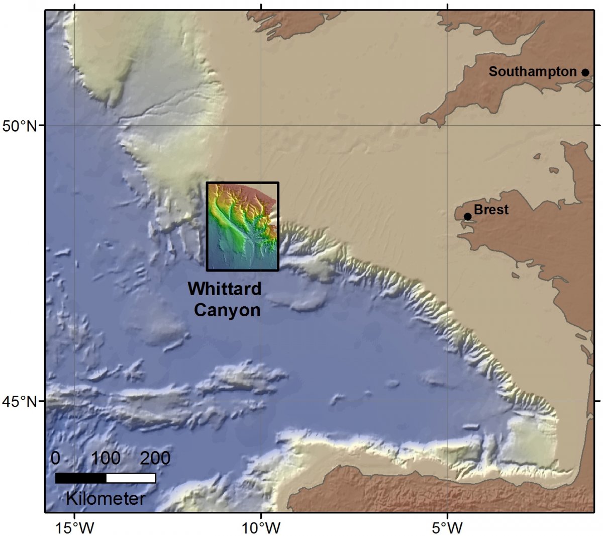
Expedition JC125 is part of the ERC Starting Grant project CODEMAP (COmplex Deep-sea Environments: Mapping habitat heterogeneity As Proxy for biodiversity, Grant No 258482), and has affinities with the NERC MAREMAP programme. It will focus on the Whittard Canyon, a large submarine canyon system along the Celtic Margin, south-west of Ireland and the UK.
Overall, the aims of the JC125 cruise are:
- To carry out further habitat mapping at different resolutions in Whittard Canyon, to increase our understanding of the system and to test and improve the predictive habitat models built within CODEMAP using the 2009 data
- To test and apply further sideways multibeam mapping, in order to develop a true 3D habitat model of the canyon
- To revisit key habitats in the canyon in order to establish potential changes over the last 6 years
- To measure the water column structure in the Eastern Branch of Whittard Canyon, to allow the inclusion of oceanographic parameters in the predictive habitat models.
Besides the overall CODEMAP aspect, there are two additional short sections to this expedition. JC124 comprises 5 days at the start of the cruise, aimed at collecting seabed data for the UK Government (DEFRA, JNCC and CEFAS)in the recommended Marine Conservation Zones (rMCZ) ‘Haig Fras’ and ‘SW Approaches Canyons’. Also for this work we will use the AUV and ROV – the SW Approaches Canyons are located directly next to Whittard Canyon. The work there will be integrated with the Whittard Canyon work. JC126 covers 3 days at the end of the cruise, and is aimed at the technical trials of a novel vibrocoring system for the ROV. At the present day, it is impossible to obtain good sediment cores in well-sorted sands at depths beyond 1500m. The new vibrocorer is designed to make this possible, and having the opportunity to test it in some of the sandy deposits in Whittard Canyon is an exciting prospect.